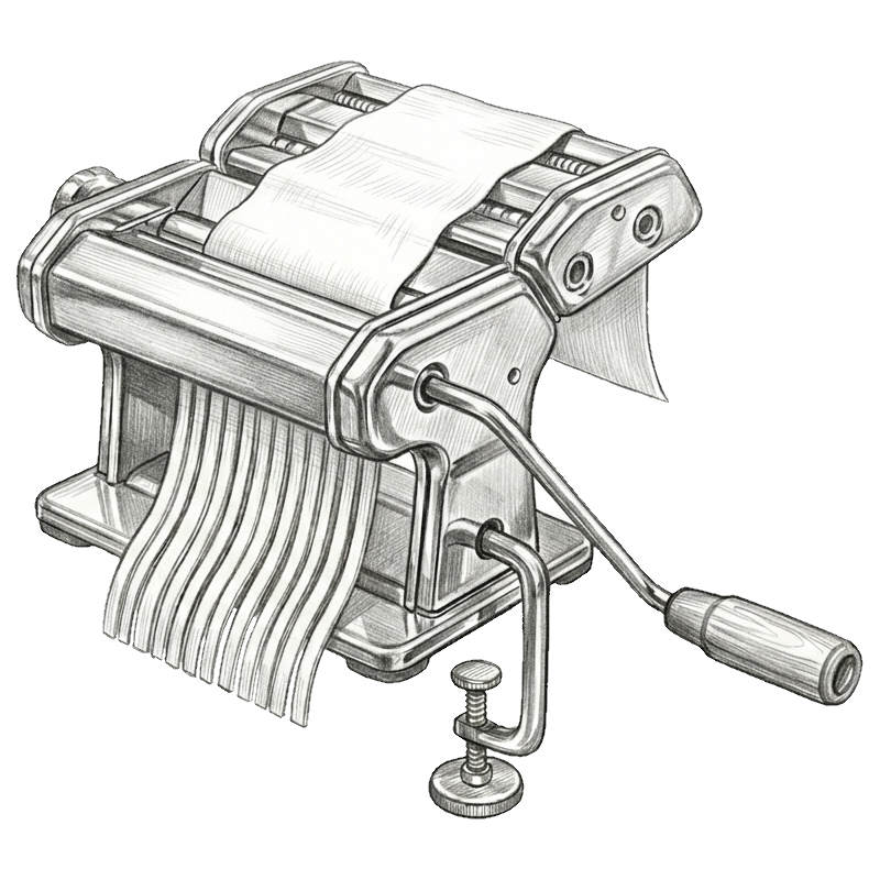
"Sfogliatrice" = "Mechanized Pasta Cutter"
Sfogliatrice is both a CLI tool and a Rust library to handle tessellation of complex GeoJSON inputs. It understands the full set of GeoJSON types, and can process thousands of elements in a few seconds because of its intermediate optimization step.
Requires macOS 11 Big Sur or newer.
$ brew tap racum/tap  # Setup (only needed once).

$ brew install sfogliatrice  # Install.

$ brew upgrade sfogliatrice # Update.$ # Set up APT source (only needed once):
$ curl -fsSL https://racum.github.io/apt/key.gpg \
| sudo gpg --dearmor -o /etc/apt/keyrings/racum.gpg \
&& echo "deb [signed-by=/etc/apt/keyrings/racum.gpg] https://racum.github.io/apt stable main" \
| sudo tee /etc/apt/sources.list.d/racum.list
$ sudo apt update && sudo apt install sfogliatrice # Install or update.Static binary, zero runtime deps. Pick the right arch:
$ # x86_64:
$ curl -L https://github.com/racum/sfogliatrice/releases/latest/download/sfogliatrice-linux-x86_64.tar.gz | tar xz
$ sudo mv sfogliatrice /usr/local/bin/

$ # arm64:
$ curl -L https://github.com/racum/sfogliatrice/releases/latest/download/sfogliatrice-linux-aarch64.tar.gz | tar xz
$ sudo mv sfogliatrice /usr/local/bin/Requires Windows 10 or newer.
> scoop bucket add racum https://github.com/racum/scoop-bucket  # Setup (only needed once).

> scoop install sfogliatrice  # Install.

> scoop update sfogliatrice  # Update.
The zipped .exe (x86_64 and arm64) can also be downloaded directly from the GitHub releases page.
Sfogliatrice was developed in Rust, thus it requires its toolchain; if you already have it available, you can install it with cargo:
$ cargo install sfogliatrice$ sfogliatrice --help
Tessellate GeoJSON geometries into satellite survey targets and coverages.
Usage: sfogliatrice [OPTIONS] <GEOJSON_FILE>
Arguments:
<GEOJSON_FILE> Input GeoJSON file (use - for stdin)
Options:
-n, --no-targets Hide target points and lines
-c, --coverages Show coverage polygons
-i, --intermediates Show polygons from intermediate step
-o, --original Show original input elements
-a, --all Show everything (targets, coverages, intermediates, original)
-e, --expansion <EXPANSION> Target expansion in meters [default: 5000]
-w, --width <WIDTH> Strip width in meters [default: 5000]
-l, --max-length <MAX_LENGTH> Strip max length in meters [default: 50000]
-m, --min-overlap <MIN_OVERLAP> Minimum strip overlap in meters [default: 200]
-f, --full-precision Do not round coordinate decimal points
-p, --pretty Pretty-print JSON output
--line-targets Force all targets as lines (no points)
--square-coverages Show point coverages as squares
--heading <HEADING> Target heading angle in degrees (0.0 means north to south)
-b, --brute-force Try many headings for better results
--ignore-holes Ignore Polygon holes
-v, --version Print version information
-h, --help Print helpFor the following examples, consider this polygon over the Gran Canaria island:
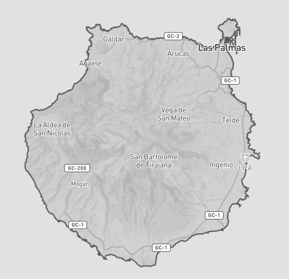
Targets are the result of tessellation, meaning the points and lines that would be sent to satellite tasking. Sfogliatrice always outputs the tessellation results to stdout as GeoJSON. Given the common use-case scenario for this tool, targets are enabled by default, but they can be ignored with the -n / --no-targets option.
$ sfogliatrice fixtures/gran_canaria.geojson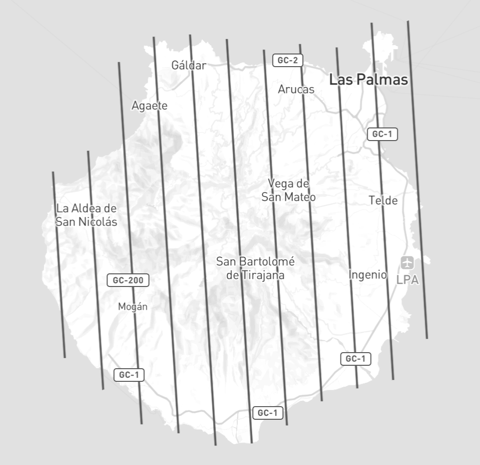
Coverages are the projected area from the targets. They are also known as “strips”, but since this tool also returns points that could be projected as circles, the name “strips” does not convey the whole meaning.
To return the coverages in addition to the targets (in the same GeoJSON structure), use the option -c / --coverages. Combining -c and -n would result in only returning the coverages.
$ sfogliatrice -n -c fixtures/gran_canaria.geojson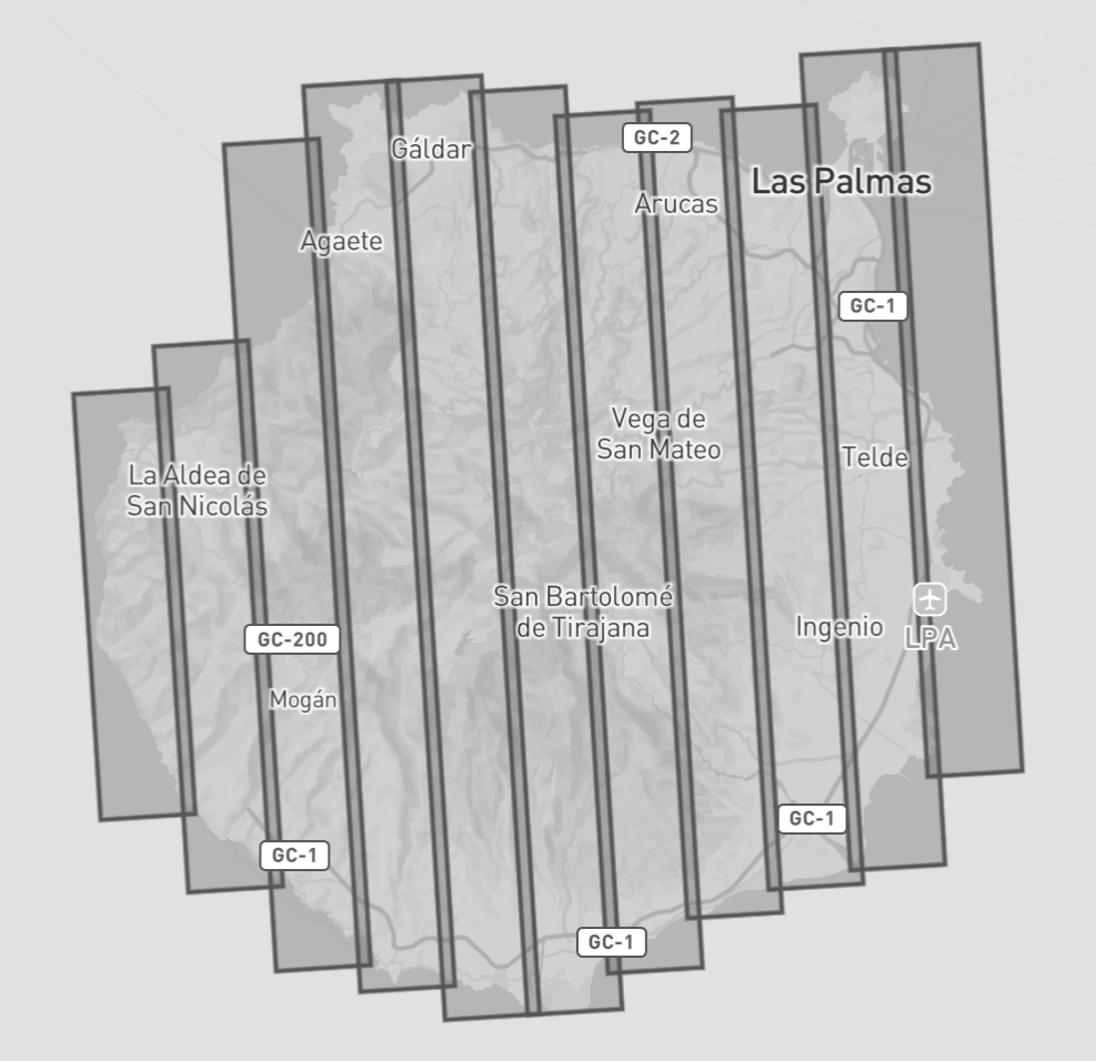
Intermediates are the polygons representing the intermediate state of the tessellation algorithm, when we try to combine nearby polygons to optimize the results.
This can be used for debug or as a pre-processing step to tessellate using different libraries/tools.
To return the intermediates, use the option -i / --intermediates.
$ sfogliatrice -n -i fixtures/gran_canaria.geojson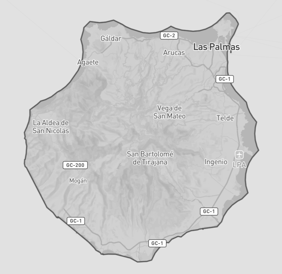
As an optimization step, the tool reduces the precision of the coordinates to 6 decimal places, if you are having problems with that, or got an invalid GeoJSON output, try using the full precision with the option -f, --full-precision.
$ sfogliatrice fixtures/gran_canaria.geojson | jq -c '.features[0].geometry.coordinates'
[[-15.388633,28.192086],[-15.365164,27.847629]]

$ sfogliatrice -f fixtures/gran_canaria.geojson | jq -c '.features[0].geometry.coordinates'
[[-15.388633491248596,28.192085832235954],[-15.365164062590058,27.847629496691788]]If you are integrating with a system that expects only LineStrings (no Points), use the option --line-targets to force all points into lines.
If you prefer to see the coverages as squares, even coming from points, use the option --square-coverages. Please notice that you also need to use -c / --coverages to see the effect of this option, given it doesn’t affect the tessellation itself.
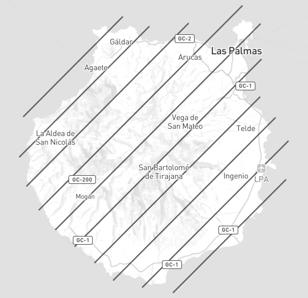
By default, the tool automatically finds the optimal strip orientation for each polygon using its minimum rotated bounding rectangle. If you need strips to run in a specific direction use --heading to fix the orientation.
The angle follows a clockwise convention starting from North: 0 means North-South strips, 90 means East-West strips, and so on.
$ sfogliatrice --heading 45 fixtures/gran_canaria.geojsonNotice the 45 degrees lines now:
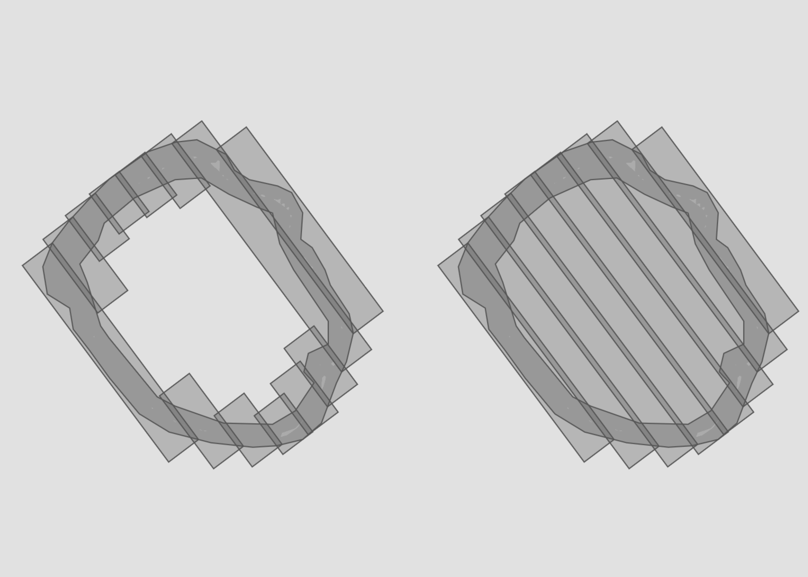
By default the strip heading comes from the geometry's minimum rotated rectangle, which is fast and works well for most inputs. Brute force goes further: it sweeps all possible headings, refines around the best one it finds, and picks whichever orientation produces the fewest targets. Each part of the geometry is optimised independently, so irregular or multi-part inputs benefit as much as simple ones. The result is the most compact survey plan possible, at the cost of noticeably more processing time on large inputs.
$ sfogliatrice -b fixtures/gran_canaria.geojsonWhen the input polygon(s) contains "holes" (interior rings), sfogliatrice respects them by default. Strips are clipped so they do not cover the hole area. If you want to ignore all holes and treat the polygon as solid, use --ignore-holes:
To use Sfogliatrice as a library, you can simply add it as a dependency via cargo:
$ cargo add sfogliatrice_libFrom geo geometry:
use geo::{Geometry, polygon};
use sfogliatrice_lib::{Config, tessellate};

fn main() {
    // Get your geometry ready:
    let polygon = Geometry::Polygon(polygon![
        (x: -15.332574, y: 28.217488),
        (x: -15.865546, y: 28.217488),
        (x: -15.865546, y: 27.719770),
        (x: -15.332574, y: 27.719770),
    ]);

    // Set your tessellation options: (strips 10Km wide)
    let config = Config {strip_width: 10_000.0, ..Config::default()};

    // Run tessellation:
    let result = tessellate(&[polygon], &config);

    // Use the results:
    println!("Targets: {}", result.targets.len());  // Outputs: Targets: 10
}
From Serde GeoJSON:
use serde_json::json;
use sfogliatrice_lib::{Config, tessellate_geojson_to_geo};

fn main() {
    // Get your GeoJSON ready:
    let geojson = json!({
        "type": "Polygon",
        "coordinates": [[
            [-15.332574, 28.217488],
            [-15.865546, 28.217488],
            [-15.865546, 27.719770],
            [-15.332574, 27.719770],
            [-15.332574, 28.217488]
        ]]
    });

    // Set your tessellation options:
    let config = Config { strip_width: 10_000.0, ..Config::default() };

    // Run tessellation:
    let result = tessellate_geojson_to_geo(&geojson, &config);

    // Use the results:
    println!("Targets: {}", result.targets.len());  // Outputs: Targets: 10
}
The CLI parameters actually just follow the library’s Config parameters; check the notes on the CLI usage and you’ll know how to set this:
pub struct Config {
    pub strip_width: f64,
    pub min_strip_length: f64,
    pub max_strip_length: f64,
    pub min_overlap: f64,
    pub expansion: f64,
    pub shard_density_ratio: f64,
    pub shard_radius: f64,
    pub force_line_targets: bool,
    pub force_square_coverages: bool,
    pub heading: Option<f64>,
    pub brute_force: bool,
    pub ignore_holes: bool,
}Before you build it, you need some requirements first:
$ rustup target add wasm32-unknown-unknown
$ cargo install wasm-pack
Then, on sfogliatrice_wasm folder, run:
$ wasm-pack build --target web
$ python3 -m http.server 8080
That will build the WASM package and run a webserver, then open the page http://localhost:8080/test.html
There is also an online demo here: https://racum.blog/sfogliatrice/
There is no PyPI release, but this can be installed directly from the repository. Rust must be installed first, then:
$ pip install "sfogliatrice @ git+https://github.com/racum/sfogliatrice.git#subdirectory=sfogliatrice_py"Usage:
import sfogliatrice

result = sfogliatrice.tessellate(
    geojson={"type": "Polygon", "coordinates": [[...]]},
    strip_width=10_000,
    brute_force=True,
)
See sfogliatrice_py/example.py for a full example.
If you want to develop, you need maturin to build it:
$ cd sfogliatrice_py
$ python3 -m venv .venv
$ source .venv/bin/activate
$ pip install maturin

$ maturin develop
$ python3 example.py
Just create a PR, but try to follow some basic guidelines:
- Look at the current structure and try to emulate it.
- One format per file, unless they are related.
- Run
cargo fmtandcargo clippybefore committing.
Sfogliatrice is under the MIT License.